Umwelthauptstadt Hamburg
Elbvertiefung
Hamburger Hafen
Sauerstoffloch
Baden und Fische in der Elbe
Plan für die Elbe Wasserrahmenrichtlinie
Hafencity
Heavy Metall / Kupferproduktion / -Mine
Energiefragen
von Ämtern und Behörden
Sonstige Probleme
Impressum
Datenschutz


Minespotting

The US Space Agency NASA produced world maps from satellite views, tediously stiched from hundreds of cloudless images. Thus earth's surface can be displayed in one high resolution picture, either in (visible) daylight, or at night, illuminated by man's activities. Clearly divided is the planet, into glittering zones of wealthy countries, and sparsely lit poor nations. The darkness of the island of New Guinea is punched by few major cities, like Port Moresby, and the big mining projects.

New Guinea at Night
click for full resolution picture!
The Earth-at-Night view is underlayed by the world digital elevation model in faint blue tones. The resolution of the full szene is approximately 2.5 km/pixel, so the whole earth is a very bulky file. But don't fear, the compressed jpeg cut of New Guinea comes with few bytes.

The oil fields of Kutubu shine brightest, the gold mines of Lihir, Misima, and Porgera, and the copper pits of Ok Tedi and Freeport make their mark. Compared to the cities, they demonstrate the importance of mining industries to the country.

But we all know the problems we will see, when we take a closer look at daylight, and talk to the people who live there.

Another view from space on 
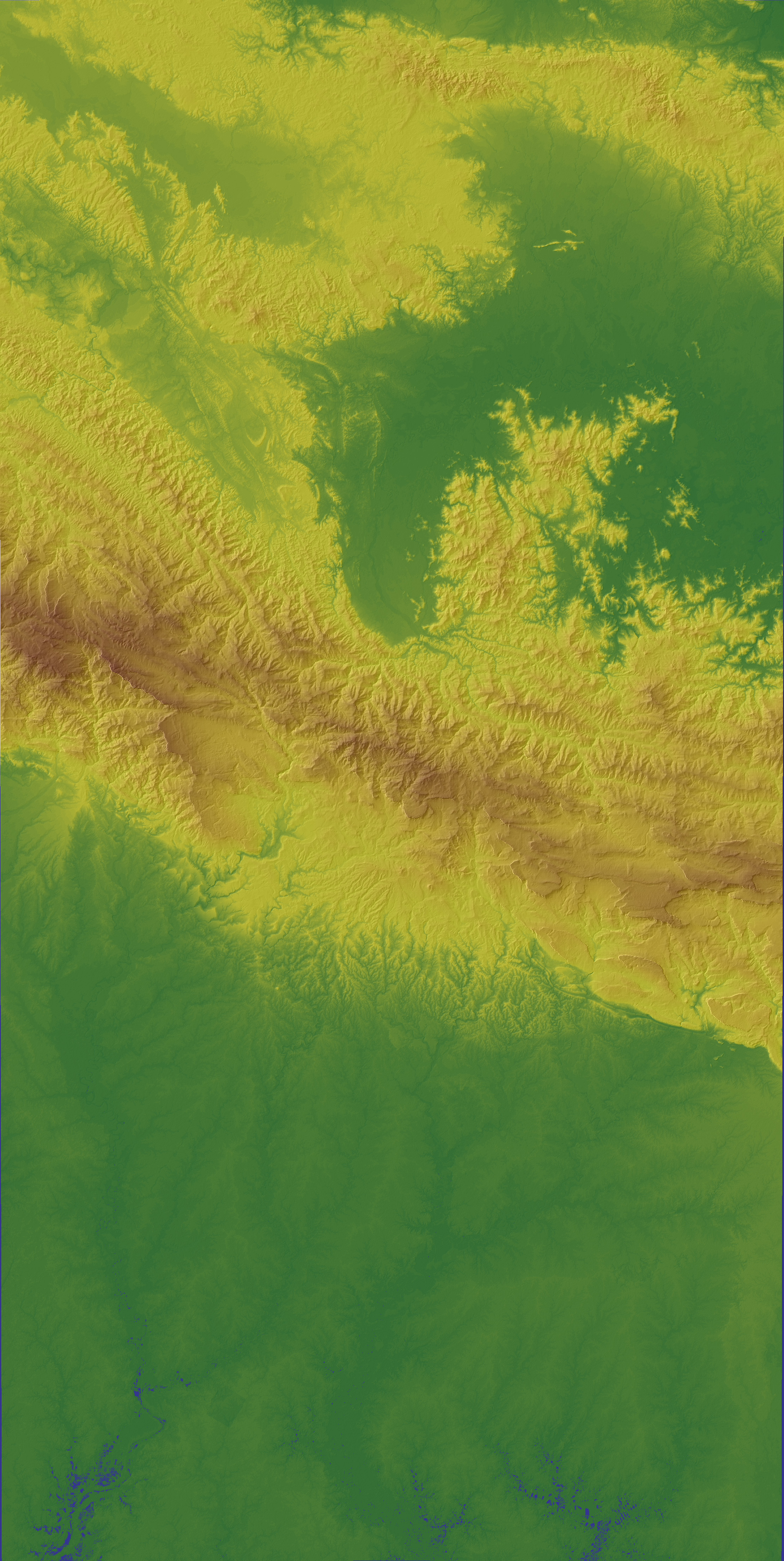
earth  is possible by radar waves. The advantage is, that radar carries its own source of light on board the satellite, and it permeates clouds. If the radar echo from earth's surface is detected by two antennae, one can produce a stereoscopic view. From a space shuttle the surface of earth between the 60th parallels was scanned. Still, the evaluation of the very bulky files has not been completed, however, the raw data are provided by NASA.

8 scenes were downloaded from NASA's srtm ftp site. These were imported to Idrisi (version 2 for windows). Raw data contain "spikes and wells", especially on large surface water areas and wetlands, and at cliffs in mountain areas, like the "Hindenburg Wall" on New Guinea. These gaps were identified as an Idrisi image, buffered by a ring of pixels containing true elevation values. From the buffer-pixels, the void areas were filled by Thiessen-polygons (also named Voronoi Tesselation), and the result pasted on the original image to replace improbable values. Still, this proceedure does not yield real elevation data, but with respect to the inaccuracies of the radar method, and keeping in mind the precautions made by NASA, it is the best Digital Elevation Model available to the public on such a resolution and covering such a large area.

shaded DEM of upper Ok Tedi Valley

3dim View of upper Ok Tedi Valley
A 3-dimensional window of the upper Ok Tedi Valley

The complete map, a composite of  elevation and hillshaded image in jpeg-format, georeferenced for use in GIS software, can be downloaded, but beware of a 2.5 MB load.
More minespotting see next page

created Dec. 2003
update September 2004
goto more mine mapsmore minespotting

NASA Visible Earth Pages

shuttle radar topo mission
ftp download site srtm data

back to Ok Tedi pages

Homepage "Save the Elbe"


schnappfisch

Förderkreis »Rettet die Elbe« eV


Nernstweg 22, 22765 Hamburg, Tel.: 040 / 39 30 01, foerderkreisrettet-die-elbe.de
Logo RdE Fischkutter
Home  Über uns  Alternative Hafenrundfahrt  Links  Presseerklärungen  Archiv